Blue Marble
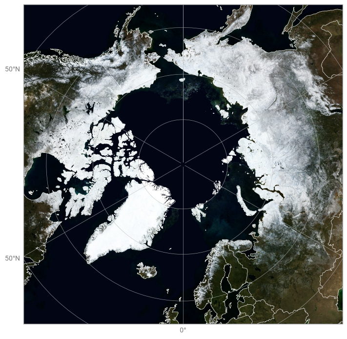
This example demonstrates how to plot a flat PNG image with a known domain and coordinate system on an earthkit-plots Map.
[1]:
!wget -O blue-marble.jpg https://eoimages.gsfc.nasa.gov/images/imagerecords/74000/74167/world.200410.3x5400x2700.jpg
--2026-06-23 15:15:08--  https://eoimages.gsfc.nasa.gov/images/imagerecords/74000/74167/world.200410.3x5400x2700.jpg
Resolving eoimages.gsfc.nasa.gov (eoimages.gsfc.nasa.gov)... 129.164.142.12
Connecting to eoimages.gsfc.nasa.gov (eoimages.gsfc.nasa.gov)|129.164.142.12|:443... connected.
HTTP request sent, awaiting response... 200 OK
Length: 1766694 (1.7M) [image/jpeg]
Saving to: ‘blue-marble.jpg’

blue-marble.jpg     100%[===================>]   1.68M  1.72MB/s    in 1.0s

2026-06-23 15:15:10 (1.72 MB/s) - ‘blue-marble.jpg’ saved [1766694/1766694]
[2]:
import earthkit.plots as ekp

chart = ekp.Map(domain="Arctic")

chart.image("blue-marble.jpg", extent=(-180, 180, -90, 90))

chart.coastlines(color="white", linewidth=0.5)
chart.gridlines()
chart.borders(color="white")

chart.show()